US · California
Castle Rock 2026 | A Hike To The Ridge Overlook With The Boys
A short hike with three boys at Castle Rock State Park, logging 3.3 mi, 682 ft of gain, and 1h44m on Strava - from a giant redwood root sculpture to a ridge overlook.
2026-09-07 · 4 min
Trip Map
Castle Rock 2026 | A Hike To The Ridge Overlook With The Boys · 1 stops
1. Castle Rock State Park
From the root sculpture to the ridge overlook
Region
US
Reading Time
4 min
Map Stops
1 stops
Took three boys out for a short hike at Castle Rock State Park this weekend. Strava logged 3.3 mi, 682 ft of elevation gain, and 1h 44m. Not a hardcore hike, but for a spontaneous weekend outing, the ridge overlook view already paid for the climb.
Overview
The route was simple: one trail out to the overlook, and Strava logged it as a small loop.
- Location: Castle Rock State Park, along Skyline Blvd
- Format: three boys plus one family hike, a small loop
- Strava:
3.3 mi,682 ftelevation gain,1h 44m - Start: a giant redwood root sculpture near the parking lot, a good spot for a photo before setting off
- End: a ridge overlook with an open view across the Santa Cruz Mountains
The Root Sculpture | A Small Ceremony Before Setting Off
There is a giant redwood root sculpture near the parking lot, its roots twisting in every direction - a perfect climbing frame for three boys to sit on for a photo. This kind of "check in before we even start" moment seems minor, but for kids it is often more exciting than the actual hike.
The Ridge Trail | Not Long, But Steadily Uphill
From the root sculpture, the trail climbs through dense conifer and oak forest. Spread across 3.3 miles, 682 ft of gain is not actually steep, but the steady climb still turned the boys from playful to head-down and quiet fairly quickly. The good news was plenty of shade, a lot more comfortable than a fully exposed route.
The Ridge Overlook | Forest As Far As You Can See
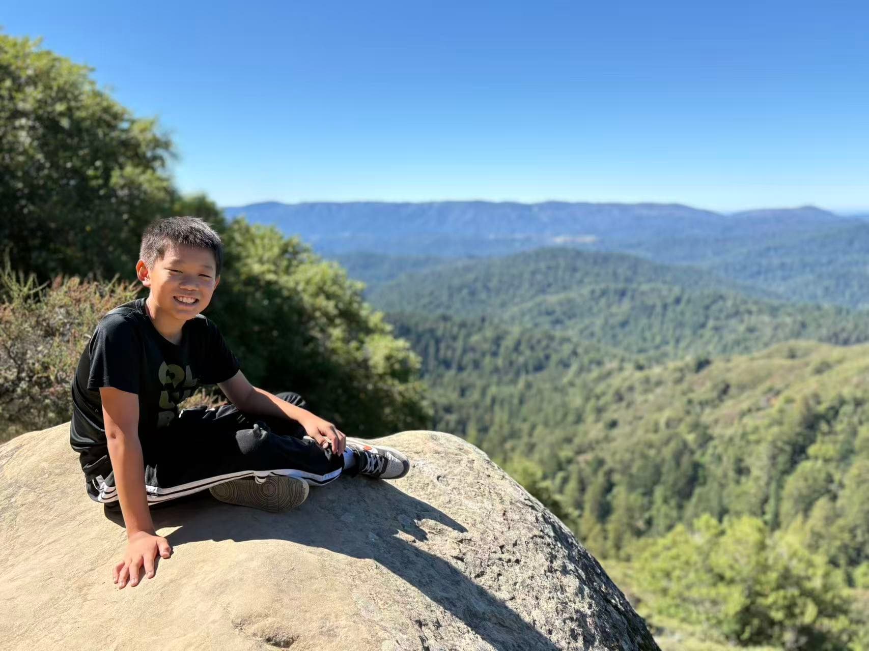
Once we reached the ridge, the view opened up all at once: conifer forest covering the entire Santa Cruz Mountains stretching to the horizon, with a hint of the bay's outline in the distance. The kids found a jutting rock to sit on, snacking while taking in the view - we spent longer here than on the climb itself.
The rock formations around Castle Rock are worth a look on their own too, weathered into honeycomb-like pockets (tafoni). Standing next to them for a photo has a different texture than a typical trail shot.
The older one finished by climbing onto an isolated boulder for a silhouette pose against the blue sky - it ended up more striking than a straightforward landscape shot.
Transportation And Prep
- Castle Rock State Park sits along Skyline Blvd (Highway 35); the parking lot is small, so arrive early on weekends.
- 3.3 mi with 682 ft of gain is a good fit for upper-elementary to middle-school-age kids; preschoolers might find the second half a bit much.
- Good tree cover makes this more comfortable than a fully exposed trail, especially for a fall afternoon.
- It's windier at the ridge overlook than in the forest, so a light jacket is worth bringing.
- If there's energy left, the park also has the longer Saratoga Gap loop - this was just the shortest version.
Takeaways
- This short Castle Rock route (3.3 mi, 682 ft gain) is a good fit for a spontaneous weekend family hike.
- Both ends are worth stopping for photos: the redwood root sculpture at the start and the ridge overlook at the end.
- Good tree cover makes it more comfortable than many fully-exposed Bay Area trails.
- This was just the shortest version - with more energy, the longer Saratoga Gap loop is worth considering next time.
Related Stories
Related stories
Recommendations prioritize the same category, then nearby regions and shared tags.

Continue Reading